What Counts Towards Biodiversity Net Gain? Understanding Habitat Units
One of the questions that comes up early in most BNG conversations is a fairly practical one: what can we actually count? Can the green roof on the commercial building contribute units? Does retaining the hedge along the southern boundary count? If we plant wildflower mix in the amenity grassland, does that score? What about the sustainable drainage pond?
The answers are sometimes yes, sometimes no, and sometimes “it depends” – which isn’t very satisfying but is at least honest. Understanding which habitat features generate biodiversity units and which don’t, and why, is the foundation for making BNG work efficiently within a development scheme rather than treating it as an afterthought that costs money without contributing to design quality.
The Three Categories of Habitat in the Metric
The biodiversity metric deals with habitat in three broad categories: area-based habitats (measured in hectares), linear habitats (measured in kilometres), and watercourses (also measured in kilometres but assessed differently from other linear features). Each category has its own unit type and its own set of habitat classifications and condition criteria.
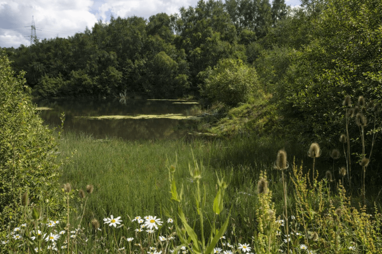
Area habitats are everything you’d normally think of as a habitat parcel – a field, a woodland block, a wetland, a grassland area, a wildflower meadow, an amenity green space. They’re assessed by mapping their extent and applying the distinctiveness and condition scores to produce a unit value in biodiversity units per hectare, multiplied by the area to give the total units for that parcel.
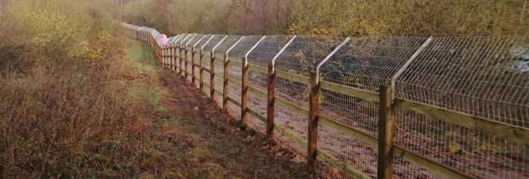
Linear habitats are hedgerows – assessed separately from area habitats because their ecological value is strongly related to their length and the quality of a linear feature rather than an area. A hedgerow is entered into the metric by its length in kilometres, with distinctiveness based on hedgerow type (native species-rich hedgerow scores higher than a species-poor or ornamental hedge) and condition assessed against the standard hedgerow condition criteria.
Watercourses – rivers, streams, ditches – are similarly measured by length and assessed for condition. They’re particularly relevant on sites with drainage features or where development is adjacent to a watercourse.
What Generates Units – and What Doesn’t
Sealed surfaces – tarmac, concrete, buildings – generate zero biodiversity units regardless of condition. That’s their distinctiveness score: nil. Removing a sealed surface and replacing it with any vegetated habitat, even introduced grassland, creates a positive unit value where there was none before. This is why brownfield development can sometimes achieve 10% BNG relatively efficiently on-site – the baseline is low (lots of sealed surface, disturbed ground, very low distinctiveness habitats) and even modest habitat creation produces meaningful gains against it.
Introduced or ornamental planting – standard garden shrubs, non-native species mixes, amenity bedding – scores at very low distinctiveness (score of 1) and generates minimal units. A development scheme that proposes predominantly ornamental planting as its BNG delivery mechanism is unlikely to get close to 10% gain from that alone.
Native wildflower grassland, on the other hand, can score at medium distinctiveness if established correctly and maintained to good condition – and it’s a realistic habitat to create within development sites as part of open space provision. The distinction between “amenity grassland” (regularly mown, species-poor, low distinctiveness) and “grassland with wildflowers” (managed for botanical diversity, medium distinctiveness) is significant in the metric. The management regime is what determines which category the habitat falls into.
Green roofs are an interesting case. The metric includes a green roof habitat type, scored at low distinctiveness. They generate units, though not many – the distinctiveness score caps their contribution. On a large commercial development with extensive roof area, they can make a modest contribution to the on-site unit total, but they shouldn’t be relied upon as a primary BNG delivery mechanism. They work best as one element of a broader on-site package.
Retained Habitat – Often the Most Efficient Contribution
Habitat that’s retained on-site and maintained in at least its current condition contributes to the post-development unit total without any temporal discount. It’s already there, already at its current condition, and doesn’t need to be established. In many cases, retaining existing habitat of reasonable quality and condition is more unit-efficient than creating new habitat that takes years to reach equivalent condition.
This creates a clear design principle: before thinking about what new habitat to create, identify what existing habitat can be retained. A hedgerow retained along the site boundary, a mature tree retained within an open space, a patch of rough grassland kept as an informal amenity area – all of these contribute units at their current condition value, immediately, without any establishment period or temporal discount.
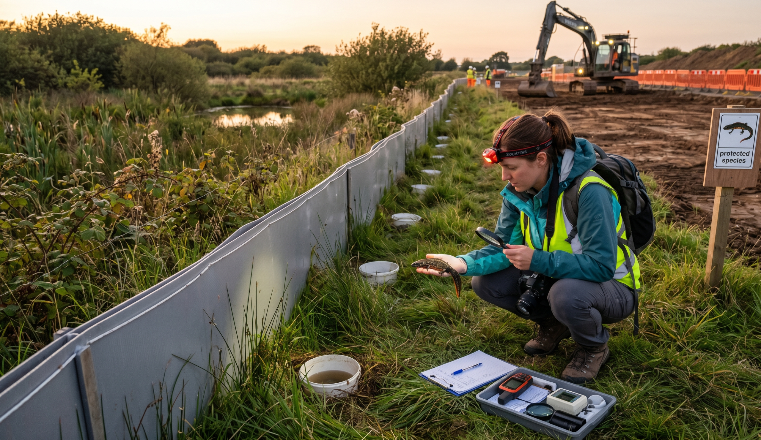
Retained habitat does need to be genuinely retained – protected from the effects of adjacent development, not just left outside the redline boundary and subsequently managed out of existence. Management commitments for retained habitat, including any necessary buffer zones, need to be included in the Biodiversity Gain Plan submitted to the local planning authority.
Enhancement vs Creation – the Distinction That Matters
The metric distinguishes between habitat creation (a new habitat on ground that previously supported a different habitat type) and habitat enhancement (improving the condition of an existing habitat). Enhancement typically produces more units per pound spent than creation, because the habitat framework is already present – you’re improving condition rather than starting from scratch, which means the temporal discount is lower and the establishment risk is lower too.
Enhancing a species-poor grassland to species-rich grassland through appropriate management – reduced cutting frequency, yellow rattle introduction, scarification and overseeding – can produce a meaningful uplift in unit value over three to five years. That’s faster than establishing new species-rich grassland from bare ground and typically costs less. Where site layout allows, identifying existing habitat that can be enhanced rather than simply retained or replaced is worth exploring in the early design stages.
Our habitat unit calculations for BNG cover both the baseline assessment and the post-development scenario – including testing different habitat design options to see which combination of retention, enhancement, and creation produces the most efficient unit total within the constraints of the scheme layout.
Sustainable Drainage and BNG – How They Interact
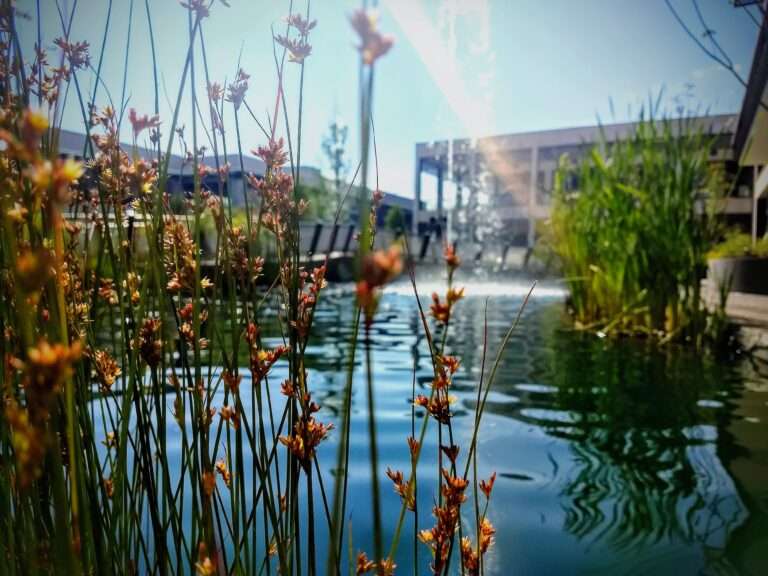
Sustainable drainage systems (SuDS) are increasingly common on development sites as both a planning requirement and a genuine approach to managing surface water. Ponds, wetlands, swales, and vegetated filter strips can all contribute biodiversity units depending on their design and management.
A SuDS pond designed and managed as a standing water habitat – with shallow margins, native marginal vegetation, and a management plan that maintains ecological interest – can generate units under the standing water or priority habitat categories. A concrete-lined attenuation tank cannot. The design of SuDS features matters enormously for their BNG contribution, and the conversation between the drainage engineer and the ecologist needs to happen at the concept design stage, not after drainage details are fixed.
Swales and filter strips managed as species-rich grassland rather than cut amenity grass contribute medium-distinctiveness grassland units. Wetland planting in marginal zones around ponds contributes wetland habitat units. None of this requires additional land – it’s about the design and management of features that need to be there anyway for drainage purposes. Getting the design right from the outset turns a SuDS requirement into a BNG asset rather than a cost centre.
What the Biodiversity Gain Plan Needs to Show
The Biodiversity Gain Plan – submitted as a pre-commencement condition discharge document – needs to demonstrate how the 10% gain requirement will be met. It contains the metric calculation, a spatial plan showing where each habitat parcel sits within the development, the management plan for each habitat type, the monitoring commitment, and confirmation of any off-site units to be used and from where.
Each habitat parcel needs to be clearly mapped, accurately measured, and correctly classified. Condition assessments need to be based on survey data, not assumptions. The management prescriptions need to be credible and specific – “grassland managed for biodiversity” isn’t sufficient; the cutting frequency, timing, and aftercare need to be set out clearly enough that a future land manager can follow them.
| Biodiversity Gain Plan Element | What It Needs to Include |
|---|---|
| Metric calculation | Pre-development baseline, post-development scenario, unit totals for each habitat type, net gain percentage |
| Habitat map | Spatial plan at appropriate scale showing all habitat parcels, clearly labelled with habitat type and area |
| Management plan | Specific management prescriptions for each habitat parcel, timing of operations, responsible party |
| Monitoring commitments | Survey frequency, condition criteria being assessed, reporting to LPA or responsible body |
| Off-site provision (if applicable) | Details of registered off-site gain site or statutory credits purchased, units provided and location |
| Legal mechanism | Conservation covenant, planning condition, or S106 obligation securing management for 30 years |
Frequently Asked Questions
Do trees count towards habitat units?
Individual trees contribute to the area habitat within which they sit – a tree within a woodland parcel is part of that woodland’s unit value. Ancient and veteran trees have a separate assessment in the metric and are treated as irreplaceable features. Street trees and ornamental planting trees in a garden or amenity setting contribute through the low or very low distinctiveness habitat category they sit within, which generates minimal units. The main contribution of trees in most development contexts is through the canopy cover they add to an area habitat parcel rather than as standalone features.
Can habitat outside the red line boundary contribute to BNG?
Not as on-site gain – the red line boundary defines the development site for BNG purposes. Habitat outside the red line that’s being created or enhanced as part of the development’s mitigation strategy needs to be registered as an off-site gain site and assessed accordingly, with the appropriate spatial risk multiplier applied. Habitat that exists outside the red line but is being retained doesn’t contribute to the development’s BNG calculation at all.
Is there a minimum habitat parcel size for the metric?
The metric doesn’t specify a minimum parcel size, but very small parcels (say, under 100 square metres for area habitats) are often not worth the effort of separate assessment – the unit value is so small as to be negligible, and combining small patches of the same habitat type into a single parcel with a weighted average condition assessment is usually more practical. For linear habitats, very short lengths of hedgerow or watercourse similarly contribute minimal units individually.
Do existing habitats on the site still count if they’re in poor condition?
Yes – everything in the pre-development baseline counts, including habitats in poor condition. Poor condition habitats score lower than good condition ones, but they still generate units that form part of the baseline. Where the baseline includes habitats that could be enhanced to better condition, that enhancement opportunity contributes to the post-development unit total. Habitats in poor condition are sometimes assumed to be valueless – in the metric, they’re not, and the distinction matters for calculating whether 10% gain is achievable on-site.
Getting the Most From What’s There
The most efficient BNG strategies are usually the ones that start from a thorough understanding of what’s already on the site – what can be retained, what can be enhanced, and where genuinely new habitat creation adds the most unit value per square metre of land allocated. That understanding comes from getting the baseline survey done early and running the metric at concept design stage rather than post-planning.
Developers who engage with BNG at pre-application stage consistently produce schemes that achieve better ecological outcomes at lower cost than those who treat it as a post-consent exercise. The unit arithmetic is the same either way – but the design options are considerably wider before planning is fixed than after.
Killingley Insights is the editorial voice of NT Killingley Ltd, drawing on decades of experience in landscaping, environmental enhancements, and civil engineering projects across the UK.