Precision Earthworks: How GPS Technology Improves Accuracy and Reduces Waste
There was a time when earthworks meant experience, instinct, and a lot of guesswork. Skilled operators could judge levels by eye, reading the ground like a map. But it wasn’t perfect – not by a long shot. A few inches too high here, a few too low there, and suddenly you’ve got wasted materials, extra fuel, longer days, and irritated clients.
That’s changed. GPS-guided machinery has quietly rewritten the rulebook for modern civil engineering. What used to rely on sight and touch now relies on data – live, precise, millimetre-level data. It’s not just about looking slick with a cab full of screens. It’s about accuracy, efficiency, and sustainability all rolled into one neat digital package.
And if you’ve ever watched a dozer move in perfect sync with a design model, blade gliding like it’s following an invisible hand – you’ll know what I mean.
The Old Way vs. The Smart Way
Let’s be fair – traditional earthworks weren’t bad. Skilled operators were (and still are) the backbone of every project. But they worked with rough benchmarks, stringlines, and the occasional bit of luck.
Set-out teams would mark the site, surveyors would check the levels, then machinery would move the earth. And move it again. And again. Because you couldn’t always see where the design level actually was until you’d already gone past it.
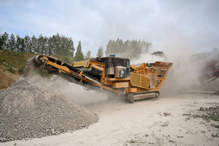
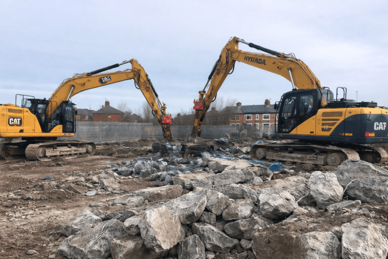
Now, with GPS systems mounted on excavators, graders, and dozers, operators know exactly where they are on site at all times. Every cut and fill aligns perfectly with the 3D design. Rework drops. So does waste.
| Comparison | Traditional Earthworks | GPS-Guided Earthworks |
|---|---|---|
| Accuracy | ±50–100mm (typical) | ±20mm or better |
| Survey Checks | Frequent, manual | Minimal, automated |
| Rework | High | Low |
| Fuel Use | Higher | Reduced |
| Productivity | Moderate | Up to 50% higher |
I’ve heard old hands say it feels strange at first – like the machine’s taking over. But give it a week, and you realise it’s the other way around: it’s giving you back control.
How GPS Earthworks Technology Works
At its core, GPS-guided earthworks combines three key elements: a base station, satellites, and onboard receivers fitted to the machinery.
The base station transmits a correction signal to refine the GPS data – without it, you’d only get accuracy to a few metres. The receivers on the machinery then track the signal and continuously update the blade or bucket position against a digital design model stored in the control unit.
So when an operator lowers the blade, the system tells them if they’re above or below grade. Constant feedback, all in real time. The screen in the cab displays colour-coded terrain, showing exactly what’s been cut and what still needs shifting.
It’s not magic. It’s maths. But it feels like magic when you watch it.
Why Accuracy Matters
A few centimetres might not sound like much, but across a site that’s thousands of square metres, it’s a big deal. Overcutting means unnecessary spoil removal and extra fill to correct it. Undercutting means poor drainage, uneven surfaces, and future settlement problems.
Accurate grading keeps material quantities predictable, which means tender estimates actually hold up. It also means haul routes, drainage systems, and foundations all line up perfectly without last-minute surprises.
In commercial and infrastructure projects, small errors multiply quickly. GPS technology breaks that chain before it starts.
Reducing Waste – The Environmental Edge
Waste reduction isn’t just about saving a few quid on diesel. Every unnecessary pass burns fuel, emits carbon, and churns up the soil more than it needs to.
By using GPS control, operators can get levels right the first time, meaning less rework and fewer machine hours. It’s not uncommon for fuel savings to reach 20–30% on large sites. That adds up – both financially and environmentally.
| Benefit | How GPS Delivers It |
|---|---|
| Fuel Reduction | Fewer passes, less idling |
| Material Efficiency | Only move what’s required |
| Lower Emissions | Less rework, shorter project time |
| Reduced Noise | Faster completion = quieter sites |
| Minimal Disturbance | Targeted excavation protects soil structure |
It’s easy to overlook how sustainable precision can be. But that’s where GPS really shines – it’s not just about productivity, it’s about responsibility.
Real-World Scenarios – Where GPS Earthworks Excels
Think of a flood alleviation scheme where drainage gradients have to be precise to millimetres. Or a new housing development where every plot’s foundation sits at a slightly different height. GPS-guided earthworks takes the headache out of that.
In complex projects like motorways or quarries, the ability to map, monitor, and adjust in real time keeps progress steady. Even in smaller works – say, a car park or sports pitch – the benefits are noticeable.
I remember seeing a GPS-equipped grader at work on a retail site near Sheffield. No pegs. No stringlines. Just a smooth, level finish that matched the digital plan to perfection. The operator said he’d cut grading time by half. Half!
And when the site engineer came to check? No adjustments needed. None.
Integration with BIM and Digital Design
We can’t talk about precision earthworks without mentioning Building Information Modelling (BIM). The two go hand in hand.
Design teams produce 3D models containing every layer, slope, and contour. Those models are then uploaded directly into the machine control system. That means there’s no translation from drawing to ground – what’s on screen is what’s on site.
Updates are faster, too. A design tweak in the office can be sent straight to machines on site via cloud software. Operators don’t need to wait for printed drawings or physical re-surveys.
It’s a feedback loop that cuts errors and boosts collaboration. Everyone’s literally working from the same ground model.
The Human Element
Technology’s brilliant, but people still make the difference. GPS doesn’t replace experience – it amplifies it.
A skilled operator can still read the ground better than any computer. The GPS just adds precision to that intuition. It’s the combination that counts.
That said, training’s essential. Understanding calibration, site setup, and troubleshooting are part of the modern operator’s toolkit. The best setups I’ve seen always have one thing in common: good communication between surveyors, engineers, and operators.
It’s not a one-button solution. But once everyone’s speaking the same digital language, it’s astonishing how smoothly things run.
Common Myths About GPS-Guided Earthworks
There are plenty of misconceptions floating around, usually from people who’ve never tried it. Let’s clear up a few.
| Myth | Reality |
|---|---|
| “It’s only for big sites.” | Not true. Small civil and landscaping projects can benefit just as much. |
| “It’s too expensive.” | Costs have fallen dramatically – and fuel/material savings often pay for it quickly. |
| “You don’t need skilled operators.” | False. You still need judgement and experience to interpret the data correctly. |
| “It’s unreliable in bad weather.” | With modern RTK and GNSS systems, reliability is excellent even under cloud cover. |
I’ll admit, there’s a learning curve. But so was going from tape measures to laser levels. And no one’s gone back, have they?
How GPS Helps with Cost Certainty
Every contractor loves the word “certainty”. GPS-guided systems make it possible to forecast cut/fill volumes before the first bucket moves.
That’s massive when you’re bidding competitively or managing tight margins. It means no nasty surprises at the halfway mark when you realise the site isn’t quite behaving as planned.
In my experience, the combination of pre-modelling and live feedback makes the difference between profit and loss on earthworks packages. You can track progress daily, compare actuals to design, and make adjustments long before it costs you.
It’s like having an accountant in the cab, quietly keeping tabs on the balance sheet.
The Link Between GPS and Technical Earthworks
Precision earthworks aren’t a standalone thing – they sit at the heart of broader technical earthworks operations. From soil stabilisation to flood defence works, GPS underpins it all.
To understand how this fits within the wider framework of ground engineering, see the section on technical earthworks. It explains how technologies like GPS, LiDAR, and digital modelling are integrated to achieve consistent results across complex terrain.
Looking Ahead – Automation and Beyond
GPS is only one part of the journey. We’re now seeing semi-autonomous machinery that can grade and compact without human input. Drones capturing real-time topographic data. AI-driven design updates.
It sounds futuristic, but the groundwork’s already here. Automation will continue to expand, but I doubt it’ll ever replace the people who truly understand the ground beneath them. Technology helps – but it doesn’t build experience.
Still, I can’t help thinking where we’ll be in ten years. Maybe the machines will call the shots. Or maybe they’ll just make us better at what we already do.
Conclusion
Precision earthworks with GPS isn’t just a fancy add-on – it’s a fundamental shift in how we shape the land. Accuracy, efficiency, sustainability: they’re no longer optional extras, they’re expectations.
We move less earth, waste fewer materials, and hit targets the first time around. That’s the beauty of precision – it’s invisible when it works.
The future of earthworks isn’t about bigger machines or louder engines. It’s about smarter thinking, guided by data, powered by skill. And the best part? We’re already standing on it.
Killingley Insights is the editorial voice of NT Killingley Ltd, drawing on decades of experience in landscaping, environmental enhancements, and civil engineering projects across the UK.